
Wednesday (June 12) – On the road by 9:15. We actually waited until we thought the traffic would be lighter, especially going through Boston. That plan worked. Until about 11 miles outside of Boston. Then it went to hell. (Note to self: Never take I93 through Boston again. Do whatever it takes to go around.)
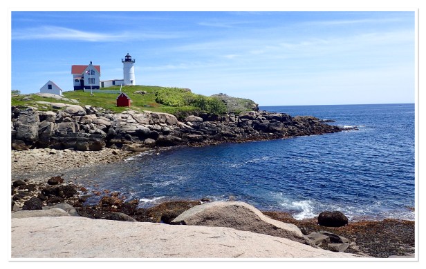
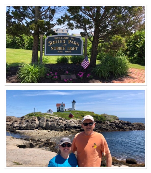
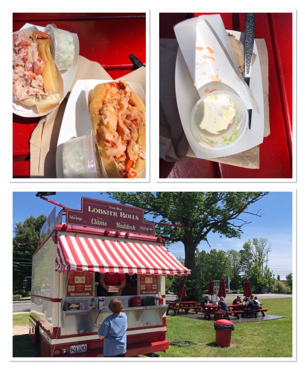
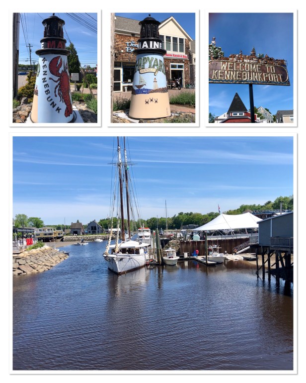
Our first stop was Nubble Light aka Cape Neddick on the way to Kennebunkport where we had a list of things to accomplish. The lighthouse was nice and it didn’t take long to snap a few pictures and we were on our way. We had planned to eat a lobster roll at Nunan’s Lobster Hut in Kennebunkport. Sadly, when getting directions to it I discovered they are only open for dinner. Bummed out I went to tripadvisor.com to see what our options were and picked another highly rated place, The Ocean Roll (a food truck in Kennebunk, not Kennebunkport). When you see locals lining up you know you’ve picked a good spot. Good stuff. I got the hot roll (with buttered hot lobster) and Bob got the cold one (chilled with mayo) – both were excellent!
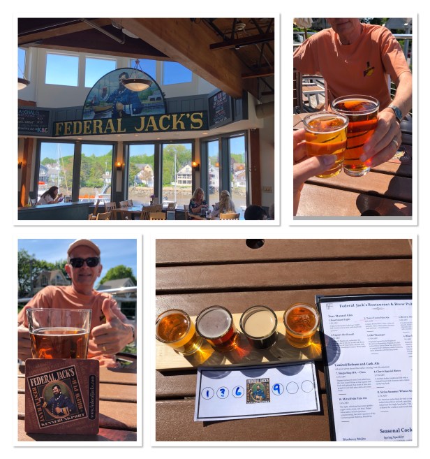
With food in our bellies we were now on the hunt for something to wash it down with. We knew there was a brewery in town and we wanted to walk around anyway so headed back to town. It took a little detective work (asking a local) to find it because it’s actually linked to a restaurant, which kind of sounded like a town to us – Federal Jacks. The brewery is located in the bottom and the restaurant is upstairs. You can get tastings at the brewery but need to go to the restaurant if you want to sit down and enjoy a beer. We sampled a couple (there was only 4 available) and went upstairs to order. I got a flight (all were really good) and Bob picked out a glass of Taint Town (ale). It was so nice to sit outside watching the sights and enjoying the blue sky and warm breeze. (Crazy to see a lady two tables down drinking Miller Lite – insert rolling eyes emoji.)
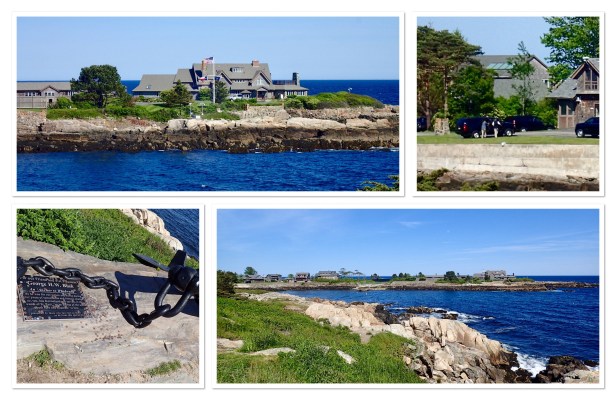
Our respite from being in the car lasted about an hour and we were back at it again. (We ended up trying to do as much as possible today because it was a pretty day and the next two are going to be cloudy, stormy and rainy. So we were cramming as much in as possible.) Goat Island Light was our next stop, but we passed Walker’s Point on the way to it. Walker’s Point is where the Bush’s compound is located. It’s been in the family for years and they even used it during both presidencies. We were told if the Texas flag is flying that’s how you know they’re actually there. Guess what? The Texas flag was flying and there were what appeared to be secret service vehicles there as well. It was pretty cool.
On to Goat Island Light – It was a few more miles down the road and was a quick in and out take a few pictures and leave kind of thing. It’s out there in the distance a bit so no closeup or great shots of this one.
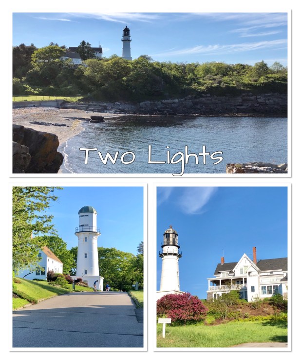
Our next lighthouse stop was at Two Light State Park where we read you can see two lighthouses. Makes sense with the name, right? We drive and drive and drive. When we finally made it to the spot that supposedly had two lighthouses, we could only find one – and it really wasn’t all that. We took a couple of pictures and stopped a local guy (at least we assumed he was local) with a fishing pole and asked where the second lighthouse was. He pointed us back in the other direction to the park/beach. So we got back in the car and drove the few miles back to the park we passed. Right there on the building it states there is no lighthouse there. The building wasn’t manned so there wasn’t anyone to ask where else to look. Backing up yet again we went back to the spot of the other lighthouse. Bob remembered reading that the second one was difficult to find. WTH? In an effort to try to get closer, thinking maybe a different perspective would help us find the second one we ran into a lady and small boy walking down the street (in a neighborhood) and stopped to ask her. Lo and behold it was like right behind us (so you know it’s pretty small, right?). So get this. Both of these lighthouses are on private property connected to residential homes. Obviously they are not working lighthouses, you can’t get any kinds of decent pictures and they’re located in a flipping neighborhood! I’m not sure I get the point at all. Why are these things even listed on a lighthouse viewing map? Oh the frustration of all the time wasted trying to find and get a shot of these bloody things.
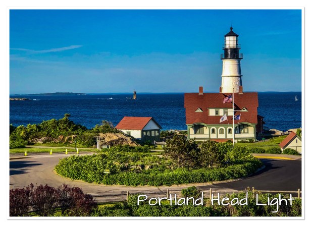
Portland Head Lighthouse is one the most photographed lighthouse in Maine. It was another 5 or so miles up the road so we sucked it up and headed that way – trying to get as much in on a pretty day, remember? It’s a beautiful lighthouse. I’d love to get some more interesting angles on it. But by this time were starving (I had someone on my hands who needed a Snicker’s Bar) so we got our shots and plugged in the address to the hotel in the Nav.
It was after 7 when we checked in and before we even unpacked we went had dinner in their restaurant. Both of us ordered the Fish and Chips. Bob cleaned his plate. That was his Snicker’s bar. Not sure if eating made it easier or harder to unload the car and bring everything up to the room and unpack. But we did. Now trying to figure out our plan for tomorrow since it’s going to be a cloudy and rainy (starting at 3:00) day.
